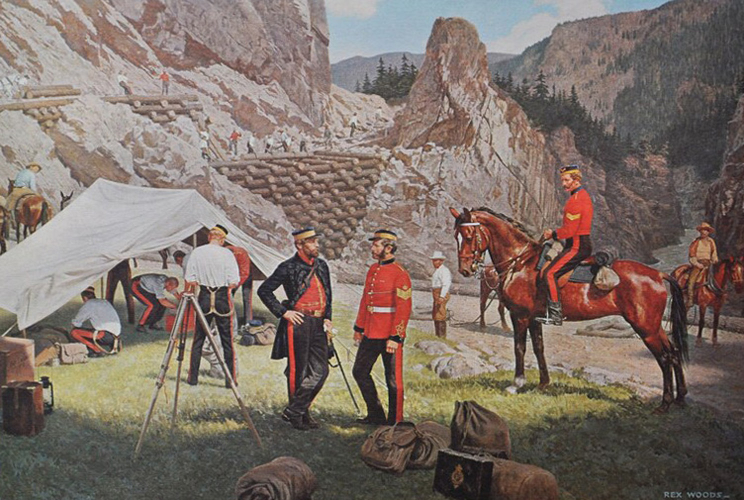
Few infrastructure projects influenced the development of colonial British Columbia more than the Cariboo (Wagon) Road. Extending about 550 kilometres from Yale to Barkerville, the road was built through challenging terrain and remains one of the nineteenth century's colony’s defining engineering achievements. Built between 1862 and 1865 during the Cariboo Gold Rush, it transformed a remote, difficult frontier into a connected region that could support settlement, commerce, and government.
In 1858, Britain appointed Colonel Richard Clement Moody Chief Commissioner of Lands and Works, Lieutenant-Governor of British Columbia, and Commander of the British Columbia Detachment of Royal Engineers. Britain sent a small force of Royal Engineers to support the colony's defence and administration by surveying, mapping, and developing infrastructure, including roads and bridges. The sappers also identified settlements with military advantages, examined harbours, and assessed the colony's natural resources. In New Westminster, the engineers established the colony's first observatory, produced maps based on their surveys and reconnaissance, and contributed to the development of other institutions and public infrastructure.
Governor James Douglas had limited military capacity to assert Crown sovereignty and to address the increasing violence of the gold rush. The discovery of gold also spurred the need for safer transportation routes than the narrow, hazardous pack trails along the steep walls of the Fraser Canyon. Douglas recognized that a dependable transportation route into the interior was essential to the colony's economic development.
The Cariboo Road presented an exceptional engineering challenge as the Royal Engineers surveyed the route from Yale towards the Cariboo goldfields. Under Moody's direction, military engineers tackled the route's most demanding sections, including the approximately 10-kilometre stretch between Yale and Boston Bar and another difficult section extending approximately 15 kilometres from Cook's Ferry along the Thompson River. The sappers’ responsibilities extended beyond simply establishing a route and building bridges. They assessed geological conditions, determined suitable road grades, identified viable river crossings, managed drainage, built retaining walls, and devised construction methods suited to unstable slopes in a rugged mountain environment. In places, they had to blast the road into the mountainside.
In 1863, the British government decided the colony could no longer afford to maintain the Royal Engineers and withdrew the detachment. Contractors continued the remaining construction, and the work was officially completed in 1865.
The military engineering work left a lasting physical and institutional legacy. Today, much of Highway 97 follows the approximate route of the Cariboo Road. It remains an enduring example of the relationship between military engineering, infrastructure, and territorial development, and a legacy of the Royal Engineers’ role in expanding commerce and settlement. What began as an urgent response to the demands of a rapidly expanding gold frontier became an important foundation for the economic and geographic development of the colony of British Columbia.